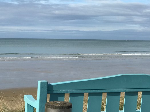
The Caitlins are not as frequently visited by foreign tourists as other parts of New Zealand. There are not many motels and restaurants are Mom & Pop places. This adds to the Caitlins’ charms. You can drive for miles through villages, farmland and wildlands, with occasional beach sitings, but nothing very commercial in sight. This is what people think of when they imagine New Zealand.
It is not hard to reach. If you fly to Auckland you can catch one of the frequent daily flights to Dunedin and within an hour you are in the heart of the Caitlins. This area is just off of Highway 1, the main route from Dunedin to Invercargill.
After an excellent day of albatross and penguin, I stayed at a motel in Mosgiel, a suburb community closer to the Dunedin airport than downtown. This provided a full day of fun in the Caitlins. You could easily spend two days in the area if you like to hike or want to spend more time on one of the beaches.
My goal for the day was the lighthouse at the Nuggets. (wait for next post!) I toodled around following local signs and stopping to admire views along the way. It was a lovely, lovely day.
Pulpit Rock was a real hiking challenge, for me. My son Tevis did not seem to work as hard to reach the top or to descend safely. It is also a mental challenge and I have lots of friends who would be terrified of the edge–especially given the 604 m drop (and no safety rails). When we saw pictures of Preikestolen or Pulpit Rock on Pinterest, all on a sunny day, we agreed it was one of the things we had to do when we visited Norway.
Preikestolen trailhead marker
We left on the first ferry from Stavanger. There was only about 50 feet of flat before the climbing began so we were glad for the cool, foggy morning. We shared the trail with hundreds of European girl and boy scouts who were in Norway for a jamboree. It did not take long for this to become a “one step at a time” physical test for me. I found all of the languages, none of them English, oddly soothing as I focused on my ascent. Tevis waited for me at several points along the trail, always looking irritatingly fresh.
The last 100 meters was the hardest. I was so relieved to get to the top and see Tevis waving from the distance. I did not find the edge particularly intimidating; it might have been different on a clear day. We ate our picnic lunch and recovered from the exertion. We agreed that even with the view-robbing fog the effort was worth it.
Tevis and American Julie made it to the top!
I did not think I was concerned about the edge at the time, but notice how I am leaning away from the edge and into my son Tevis! I kept remember the stories of people who hiked to the top with their dogs and then stupidly tossing the ball and watching in horror as their dog chased it over the edge. Preikestolen legend or true story? I do not know, I just know that I breathed a little easier for children and dogs as we hiked away from the edge.
Descending was just as challenging, mainly due to the crowds ascending and my overall weariness. It took me 2 hours to hike up and another 2 hours to hike down to the Visitor’s Center.
When I saw the Where’s My Backpack “Travel Theme: Edge“. I immediately thought of Pulpit Rock.
There are certain trips you embark on that leave you dumbfounded. You are never the same again. When you get home you’re not quite sure how to go on with life; how you understand your routine, your friends, your habits, and choices are viewed through the new lens you’ve picked up.
Two of my best friends and I zipped off to New Zealand’s North Island for two weeks (if you’re wondering, we’re saving South Island for the next trip). We didn’t pick New Zealand just because we’d already seen Europe, or Southeast Asia, Africa, the U.S., or South America (between the three of us, we’ve covered much of the world though). Needless to say, having been around the world a bit, I am really impressed by “Australia’s little brother” (words from a local, not me!). We bought our tickets to kiwi-land because we heard about and saw photos of the land’s unparalleled beauty. We’re also huge Lord of the Rings nerds. Huge. And we were hankering for a trip where we could traverse the outdoors.
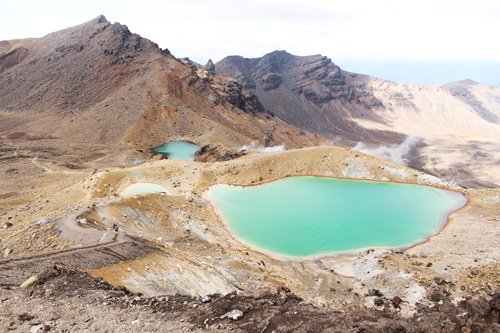
Ngauruhoe summit with the tip of Ruapehu, in the distance! At a 30º grade, the slope of Ngauruhoe is covered in loose volcanic rock, which will scuttle down at a brush from a gust of wind. The summit sits 2200km above sea level and one should allow at least 3 hours for this hike.
New Zealand is called home by one of the best hikes in the world: the Tongariro Alpine Crossing. It’s so jam-packed with wonder that I could devote a handful of blogposts to the Crossing alone. It’s best to be well-equipped with the right gear and under the right conditions. Locals warned us that unprepared people have expired on this hike so we made sure to bring twice as much water as the recommended amount per person. Good thing too! We used it all by spontaneously adding Mt. Ngauruhoe to our hike. Famously, Ngauruhoe, the most active of the many resident volcanos, is known for being Mount Doom in Peter Jackson’s Lord of the Rings trilogy.
A third of my hike up Mt. Ngauruhoe was glamorously done on all fours, just like the plight of Frodo and Sam in Return of the King–unlike them we had plenty of water and snacks on the way up and down and 0 orcs to fight. Needless to say, going “up the hill” was a challenging trek, and for me, one of the most difficult physical feats I may have accomplished in my entire life. (If you’re a mountain climber though, I’m sure this is a walk in the park for you.) “I’m going to go home and eat those hikes in Malibu for breakfast!” I thought after huffing and puffing to the summit. I’m pretty sure someone was playing “Eye of the Tiger” in my last 20 meters up too.
So why do I see my life differently after returning to the States? What has kept me up at night or silent in thought in my reunion with friends? I’m not 100% sure, but I think this volcano may have something to do with it. I didn’t expect myself to be capable of hiking Mt. Ngauruhoe. We all surprise ourselves here and there when our cooking comes out fairly edible or when we get hired for a job we didn’t think we deserved. Grace is sometimes the only explanation you have for these types of situations!
When you outdo yourself in hindsight like I did, your mind keeps wandering back to that sobbing young woman you passed on the ridge, her on her way down, and you less than half way up, not-quite-sobbing but questioning the potentially-bad life choice you may be making with every step up. Maybe you think about the very second you sat down at the crater’s edge, very much alive, dumbstruck & breathless, both from being in awe of the magnificent view and from being pathetically out of shape compared to all the Shawn-T’s chest-bumping all around you. Or the moments you were sliding down the loose scree turning back every minute or so to check for small bumbling boulders aiming to bop you on the melon!
Traveling has the purpose of never leaving you the same, and I think we sometimes forget and get more than we bargained for. Traveling leaves you vulnerable and unsure of how to proceed with your “normal” life, because you can’t! After pushing your limits, you simply can’t go back to the way you were before. The return is emotionally terrifying and exhilarating, which is why many of us sink back into our routines, forgetting why we came home so shaken up, instead of letting our experiences change us from the inside out. Besides those flashbacks, the things I think to myself now ask me how I can create more stories like this one. What am I actually capable of? How can I challenge myself to push my limits and what could I achieve if I tried passing my comfort zone? A whole new world of possibilities opens up when you’re reminded that you don’t know everything about yourself. The mountains you once thought were insurmountable seem smaller. Certainties don’t seem so certain.
To me, this is about getting closer to learning what sorts of things make me come alive. My challenge to you for your next adventure is to open yourself up to the inner processing that goes on during and after the trip. Take note of the scenery and people around you, but also take note of every emotion you have and every mental box that gets broken along the way and do the daring thing: take what you learned about yourself and the new experiences you’ve gleaned and figure out how to weave it all back into the beautifully messy tapestry that is your life!
Want to hike Ngaurahoe/Tongariro?
Get yourself on the North Island of New Zealand and you can stay in Turangi (we stayed at Extreme Backpackers–say hello to John for us!), Taupo, or Tongariro to be near the national park for an early start. Check the weather regularly (a week before, a few days in advance, the night before, and the morning of). The Tongariro Alpine Crossing is a one-day 19.4km adventure; it’s not a round trip walk, so park your car and hire a shuttle in advance to truck you to the other end of the trail (I recommend starting from the Mangatepopo trail head). Pack food and 2L of water minimum and be prepared to take your trash with you. There are no rubbish bins along the way and only 2 restroom areas. Hiking shoes are recommended, but you can get along with good cross-trainers (you want hiking boots and gloves for Ngauruhoe however). Dress in layers. Visit the government site for more info. Cheers for reading and enjoy!
Raechel Wong is an artist and blogger from Los Angeles, CA, who loves moving in whatever art she can get her hands on, whether it be drawing, writing, dancing, or performing. Read more about her global adventures at http://raechel2leeds.blogspot.com
There are so many hiking options in Humboldt County. I have lots of choices within 20 minutes of my Trinidad doorstep. I went on a longer 5 mile hike and then a short 1.6 mile hike–both with ocean views and lots of up and down.
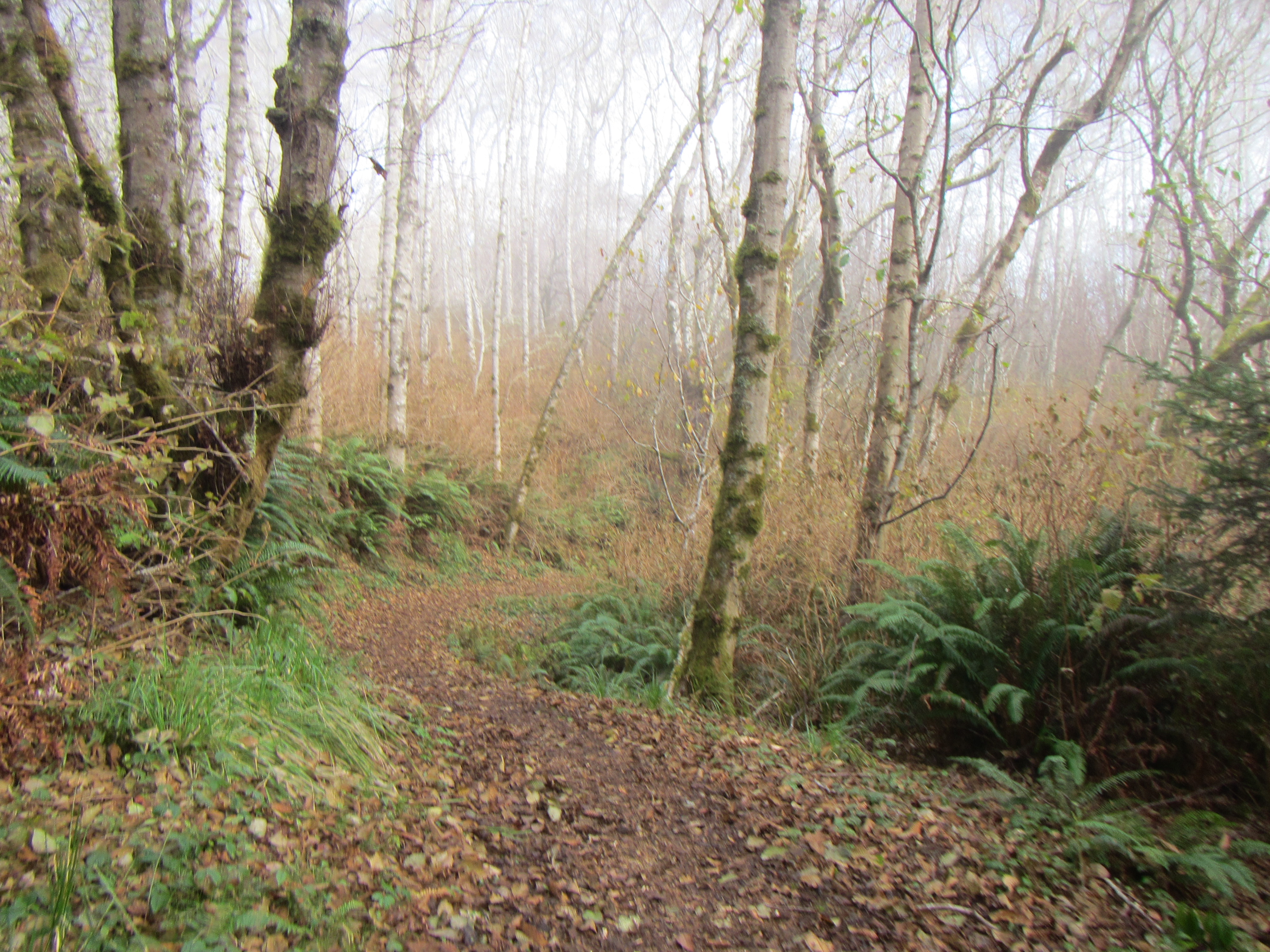
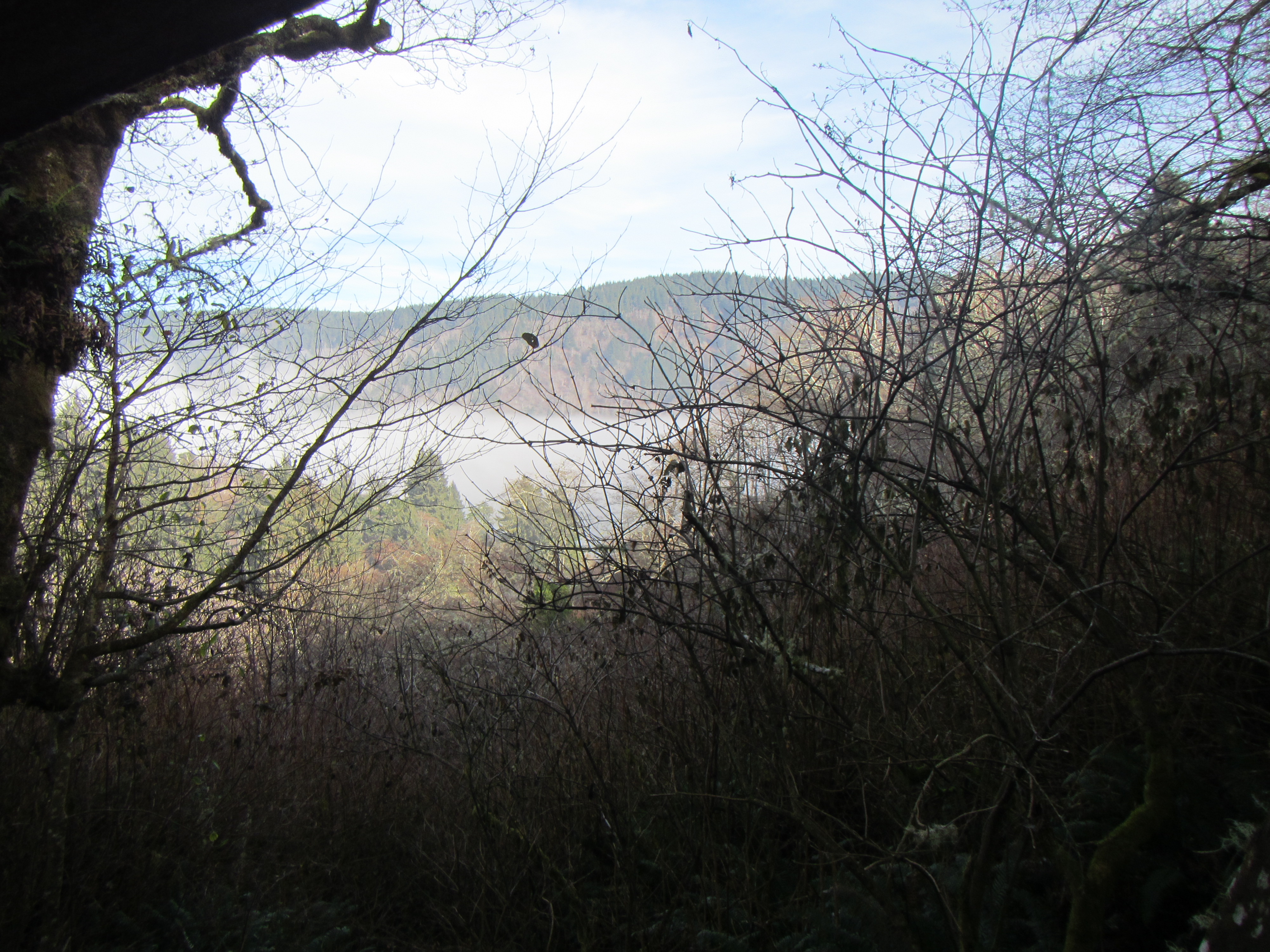
The hike began along the beach in the refreshing fog.
On New Years Day I took advantage of the California State Parks kick off to their 150th year celebration in 2014. They hosted over 40 hikes at state parks including one at the Humboldt Lagoons State Park. I arrived at the park just as they took the group photo–over 30 people of all fitness levels looked forward to the 2.5 mile hike to the lagoon and 2.5 miles back. We trooped across the beach and then headed up the trail. I am not one for group trips and it felt a bit like a wagon train walking up hill and over dale. If I had been a part of a pioneer train I would have volunteered to be a scout to get a chance to see off in the distance. Occasionally the park ranger leading the walk would stop and give us information about flora and fauna.
A variety of woodlands framed the trail.
We arrived at the lagoon and people spread out to eat their lunches at picnic tables and along the shore. I decided to head straight back so I could have the trail to myself and walk at my own pace. It took much less time to get back. There is only a shack like outhouse at the lagoon so I was happy to see the slightly nicer version at the parking lot. The hike began at 11:00 a.m. and now it was 2:00 p.m The parking lot was overflowing and a few groups had built campfires.
Lagoon.I enjoyed the solitude on the return hike.
I overhead lots of conversations and while some people are regular hikers, most people seemed to be acting on resolutions for 2014. It was a great way to start the new year whatever the motivation.
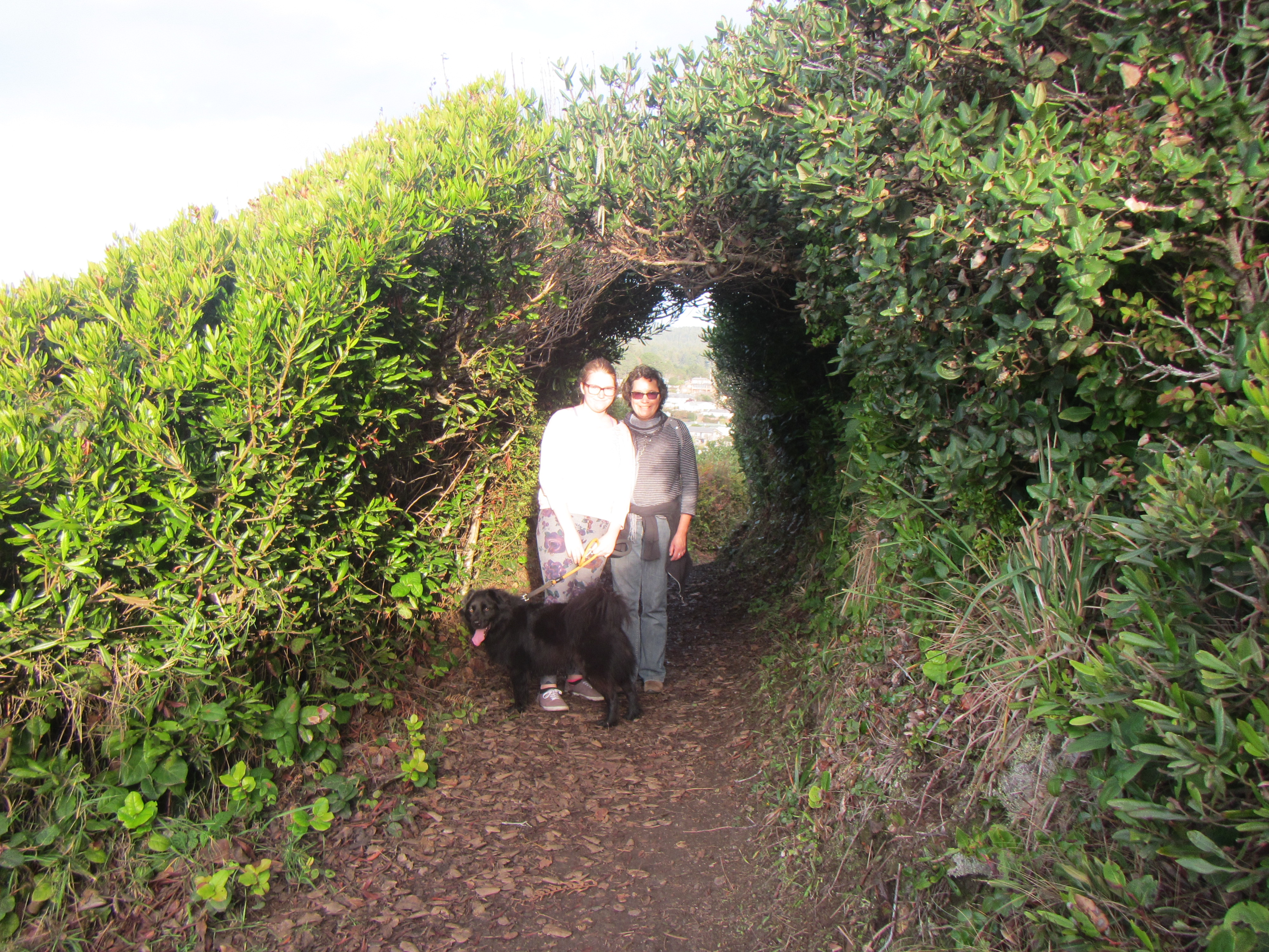
On another day H., N. and I took the dogs to Trinidad Head. You can park at the Trinidad State Beach or walk from the parking lot at the Marina and Seascape Restaurant. We walked from my rental home across the village. As you head up the hill you can turn right at the trail or continue to the left up the road. Going to the right is clockwise and involves a lot more up. The trail is protected from the wind by lovely hedges. There are numerous breaks with seating for whale watching or staring out to sea. It is not hard to imagine shipwrecks just off shore.
The dock and Seascape restaurant are next to Trinidad Head
Gorgeous views all round Trinidad Head
Friends framed by hedge archway
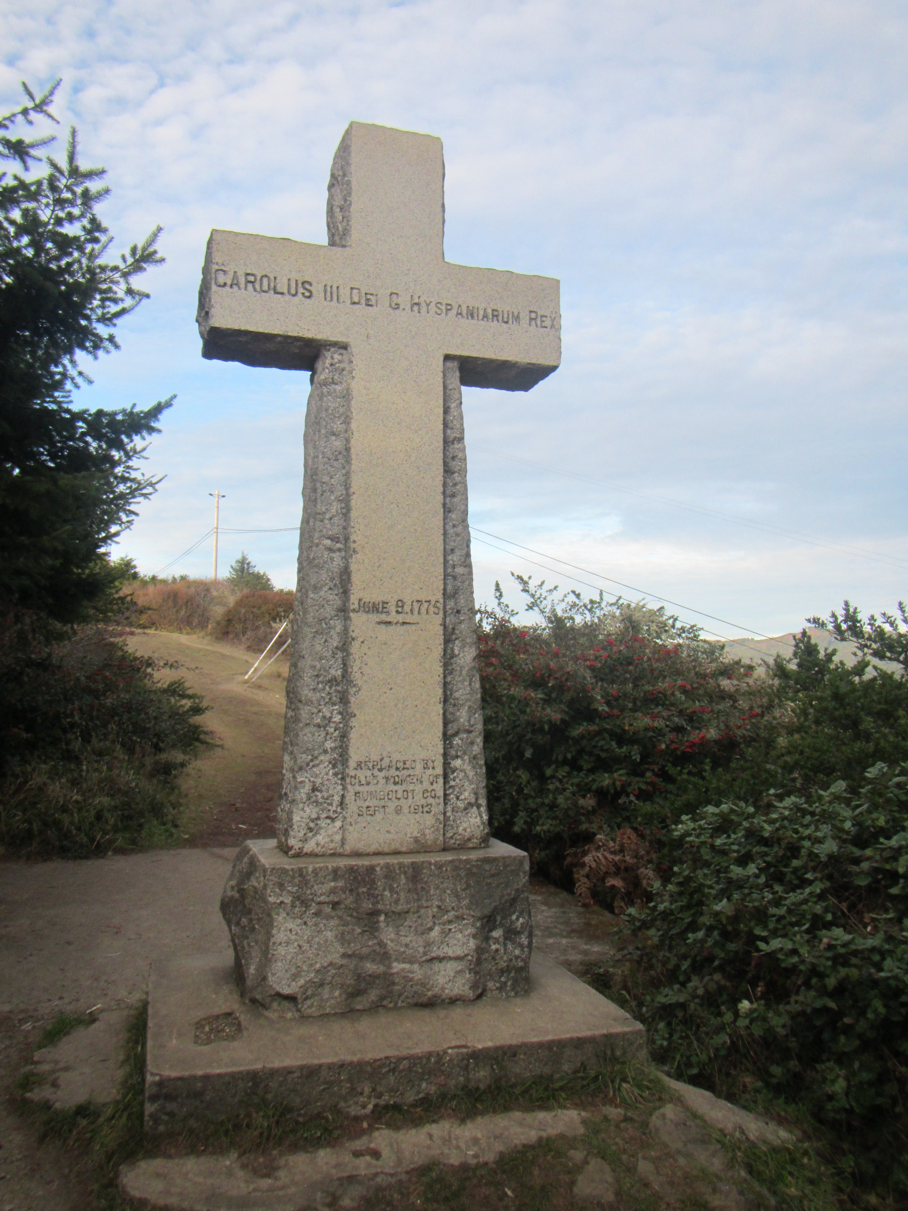
The hike is only 1.5 miles round the head and over a mile is up if you go clockwise. Near the “top” is a cross put in place by the “club women”. The return on the road is a steepish downhill. The views of the bay and village are lovely. As we returned we were passed by an older gentleman who appeared to walk this trail everyday–a rigorous and healthy routine.
The walks to the Old Home Beach are too short to be called a hike. You can reach the beach from the Memorial Lighthouse in the village or from the Parker Creek trail. Both routes involve serious stairs and were a challenge to Radar’s creaky back legs. He was a trooper; although he could not see the sea lions just offshore and I dutifully kept him on leash, he really enjoyed the the variety of smells and sights along the shore.
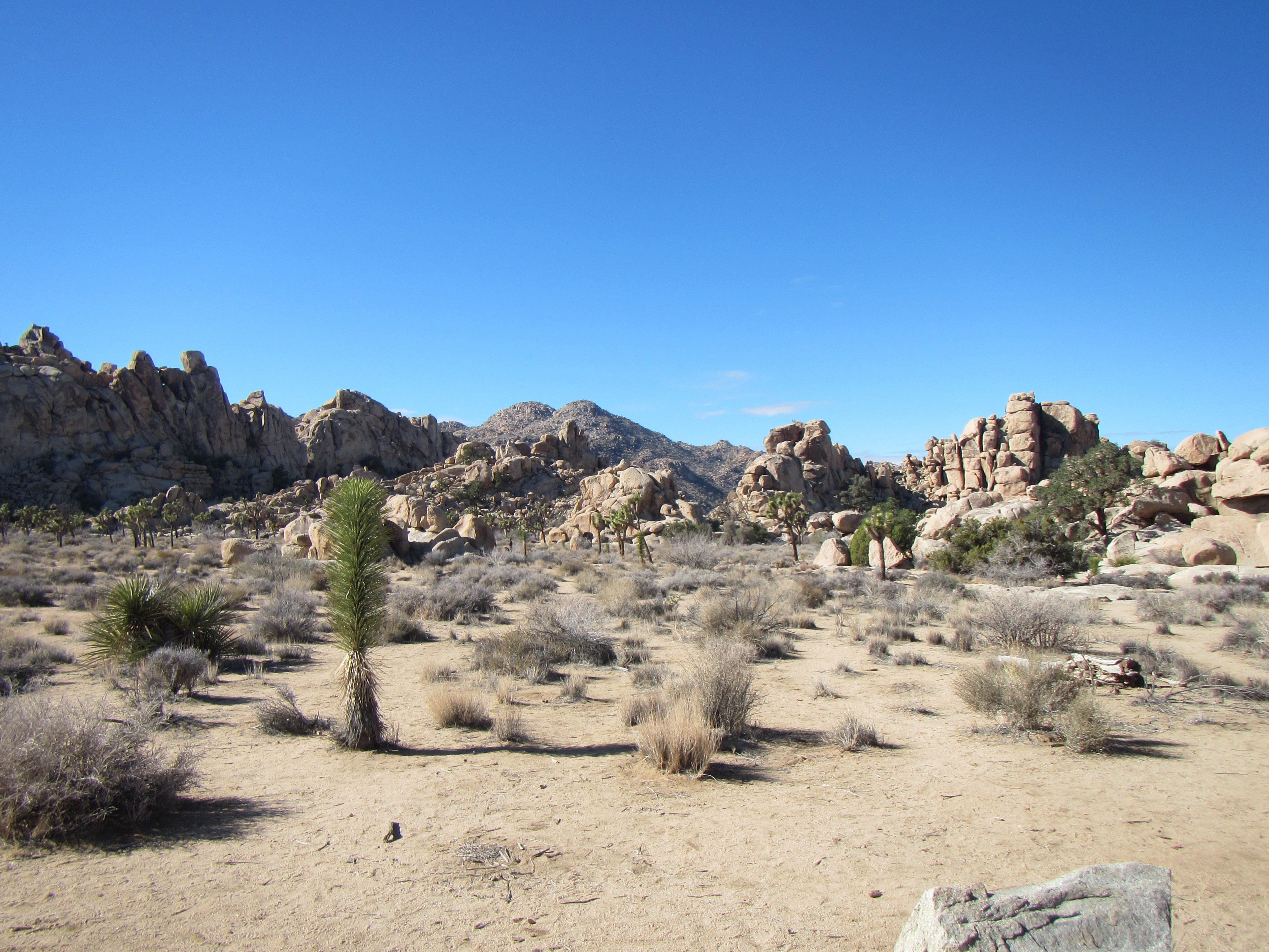
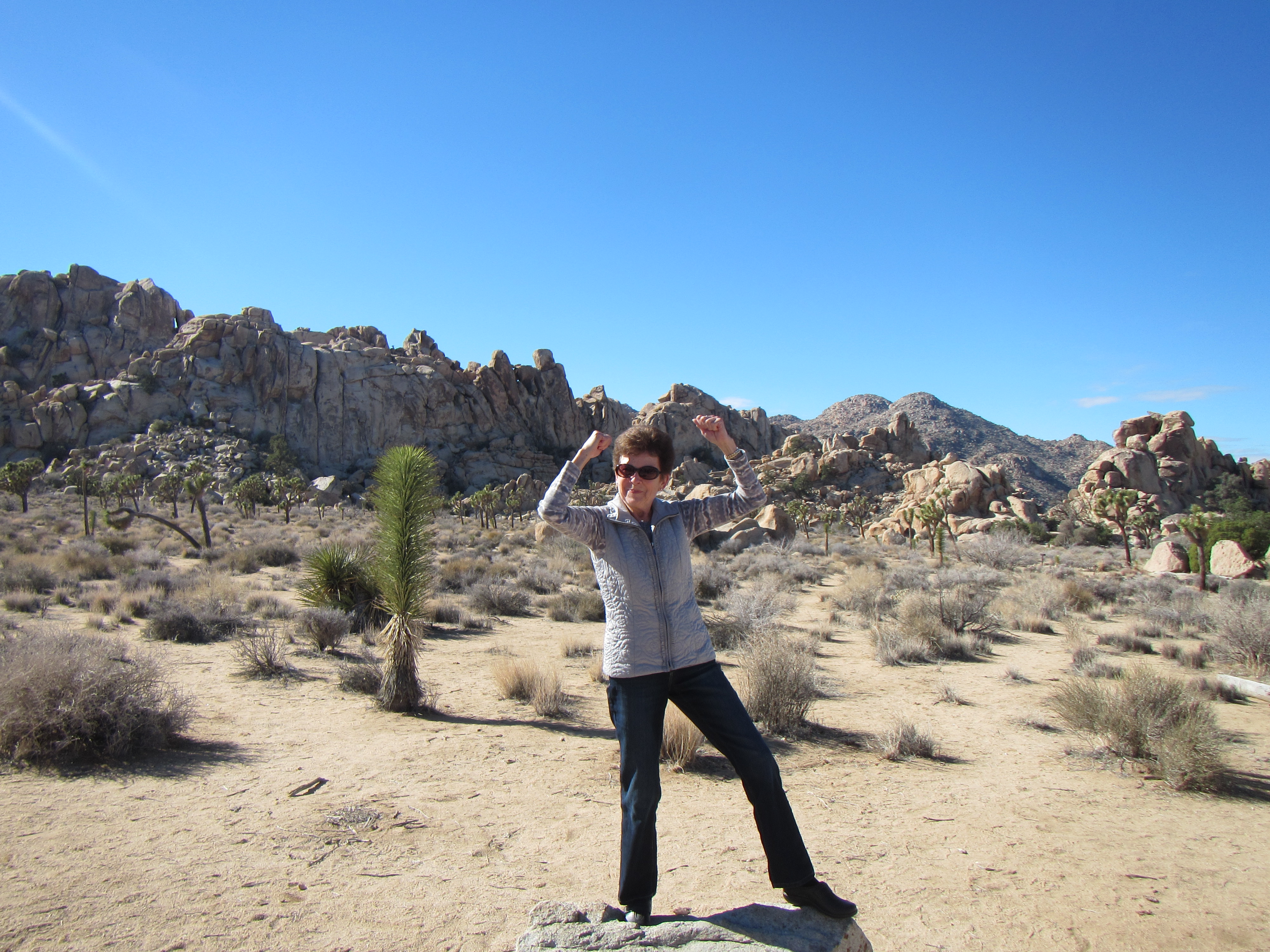
Posing with Joshua Tree and rocks at Quail Springs
It takes a moment or two, and a couple of deep breaths, to acclimate to the beauty of the desert in Joshua Tree National Park. Then the peace of the place begins to seep in my bones and I can quiet my mind and appreciate what an interesting place this is. And I can hang out here for multiple days for the low entrance fee of $15 (per vehicle)–one of the bargains of our National Park system.
The Cahuilla people lived here for centuries, then after World War I, veterans with lung damage from mustard gas sought relief in the desert climate. By the 1930s, the human pressure on this special place was increasing and activist Minerva Hoyt persuaded Franklin D. Roosevelt to declare it a national park in 1936. Today we can enjoy these special 794,000 acres where the Mojave and Colorado deserts converge under the careful management of the US Park Service.
Hemingway Buttes are another climbing spot.
It is ideal to visit in winter as the temperatures are much milder than the 110 degrees+ of summer. The days may be shorter but the night sky is glorious. You can backpack, rock climb, horseback ride, walk, hike, and camp. The park is open 365 days a year, except when the government is shut down.
The famous Joshua Tree (thanks U2), is a member of the agave family with the latin name Yucca brevifolia. It is most associated with the Mojave Desert but it can be found in the Sonoran Desert and in the San Bernardino Mountains. The Cahuilla used their tough leaves for baskets or sandals and ate the flower buds or seeds. The plants are protected so if you want to plant a Joshua Tree when you get home, ask the visitor’s center about sourcing seeds.
There are a lot of wild critters that enjoy the Park. On our drive from the West entrance to Quail Springs, Hemingway Buttes and back, we saw a red-tailed hawk and common ravens. Spend longer in the park and you may see roadrunners, Bighorn sheep and desert tortoise.
Climb on Auntie J!
The rocks are more fascinating than the wildlife. These piles of granite have been left behind after centuries of erosion. One of our party kept saying, “Who piled up all these rocks this way?” Um, God. Or time. Officially the rocks were pushed up from below by volcanic activity eons ago. “As the granite cooled and crystallized underground, cracks (joints) formed horizontally and vertically. The granite continued to uplift, where it came into contact with groundwater. Chemical weathering caused by groundwater worked on the angular granite blocks, widening cracks and rounding edges. Eventually the surface soil eroded, leaving heaps of monzogranite scattered across the land like careless piles of toy blocks.” (National Park Service brochure)
I have visited this park many times and I never tire of it. It is a must see and do If you are visiting the Palm Springs area.

 The Caitlins are not as frequently visited by foreign tourists as other parts of New Zealand. There are not many motels and restaurants are Mom & Pop places. This adds to the Caitlins’ charms. You can drive for miles through villages, farmland and wildlands, with occasional beach sitings, but nothing very commercial in sight. This is what people think of when they imagine New Zealand.