The Nuggets are Zen

IMG_9782
Isn’t it weird how on a hike you can get a view of a place that looks like you used a drone, when it is just the way the trail goes…

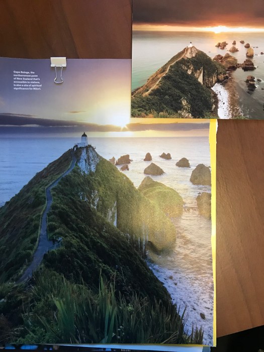
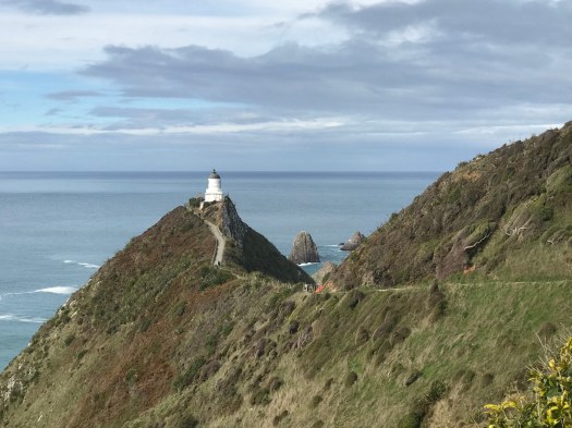
I’d seen photos of The Nuggets on-line as I planned my visit to the Caitlins. I wasn’t sure what to expect of the region, but I knew that I wanted to walk out to this lighthouse and the rocks that go by the name of The Nuggets, or Nugget Point or Kaka Point.

IMG_9808
Feeling like I was at the “end of the world” my thoughts turned to the climate crisis, the whaling genocide of last century, and inspired a collage…

The parking lot at 11:00 a.m. contained a handful of cars. Along the trail I encountered only about two dozen other people in small groups over the 3 miles roundtrip. There were times along the walk that I felt a beautiful solitude. Noise also played tricksy as I was sheltered from the sound of wind and surf by the ridge, until I stepped out (almost to the lighthouse) and it returned with a roar.

IMG_9802
Product placement: The path to the lighthouse was very easy terrain and my Allbirds did the job!

I truly enjoyed the experience and could have stayed longer at points along the way. It would be a great picnic spot with some advance planning.

IMG_0196
Whoopsie National Geographic Traveler! This is not Cape Reina, it is Nugget Point. Only at the complete opposite end of the country. This is the second time I’ve caught America’s geographer out. The other time was with the parent magazine when they asked UC Davis to review an article on The Great Central Valley and their map showed Gilroy in the San Joaquin Valley.


Leave a Reply

Fill in your details below or click an icon to log in:

WordPress.com Logo

You are commenting using your WordPress.com account. Log Out /  Change )

Twitter picture

You are commenting using your Twitter account. Log Out /  Change )

Facebook photo

You are commenting using your Facebook account. Log Out /  Change )

Connecting to %s

%d bloggers like this: